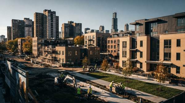
The Chicago Housing Authority has released its final “Cabrini NOW” plan for the last undeveloped stretch of the former Cabrini-Green site, and its structure is unusually concrete: roughly 4,100 mixed-income homes spread across 43 acres and 16 sites, organized into four named subareas—Rowhomes, Division, Larabee, and Sedgwick—each carrying its own targets for housing, open space, and street connections. The plan also commits to 9.1 acres of new public open space, anchored by a green corridor linking Durso Park, the Jesse White Community Center, and Seward Park. Here is how the framework breaks down.
Understanding the 'Cabrini NOW' Framework
Cabrini NOW is a development framework rather than a shovel-ready construction schedule. It sets goals and parameters for the land CHA still controls within the Near North Side community area, in Chicago’s 27th Aldermanic Ward, while individual development proposals for the sites have not yet been solicited or approved. The framework document itself is marked “Draft for Review,” and its acreage and unit figures carry explicit tolerance ranges, so the totals should be read as planning targets rather than fixed counts.
The plan also builds on a longer history. Since the early 2000s, the housing authority has brought back more than 3,500 homes to Cabrini-Green through earlier redevelopment phases, and Cabrini NOW covers only the remaining acreage—not a restart of the whole site. That distinction matters for interpreting the headline numbers: 4,100 units is what remains to be built, not the total of the neighborhood’s redevelopment.
Cabrini NOW: Development Framework by Subarea
The framework’s most distinctive organizing idea is geographic. Rather than presenting a single undifferentiated plan, CHA groups its 16 sites into the Rowhomes, Division, Larabee, and Sedgwick subareas, each with targets for housing, public open space, and street connections. Site-level figures from the framework summary illustrate how those goals translate to specific parcels. Note that the unit and acreage figures below are approximate ranges for individual sites within each subarea, not totals for the subareas themselves, and some sites appear only as combined groupings.
| Subarea | Key Development Goals | Site-Level Detail (approximate) |
|---|---|---|
| Rowhomes | New housing, public open space, and street connections | Site F: about 0.3 acres, 16 units |
| Division | New housing, public open space, and street connections | Sites B, D, E, G: roughly 1.9, 1.9, 2.5, and 2.4 acres with about 140, 230, 270, and 555 units respectively; site C (about 0.3 acres) has no units listed |
| Larabee | New housing, public open space, and street connections | Sites L, P, Q: about 7.9 acres combined, roughly 450 units |
| Sedgwick | New housing, public open space, and street connections | Includes sites K, H, M, R, and N; K alone spans about 14.2 acres with roughly 940 units, while H totals about 0.4 acres and 20 units |
Two features of this breakdown stand out. First, the subareas are very unequal in scale: the Sedgwick sites include the plan’s largest single parcel at roughly 14 acres, while the Rowhomes subarea’s detailed example, site F, is under half an acre with 16 units. Second, every subarea carries the same three-part mandate—housing, open space, and connectivity—so the framework’s uniformity of purpose coexists with sharp differences in density and land form from one zone to the next.
Mixed-Income Housing: A Community Composition
Across all four subareas, the plan calls for 4,100 units of mixed-income housing, ranging from townhomes to taller buildings. The affordability formula applies to the total, not to any single subarea: 33 to 40 percent of the units will be CHA units, up to 20 percent will be affordable, and up to 50 percent will be market-rate. In practical terms, that means public housing could account for as few as roughly 1,353 units or as many as roughly 1,640, with the balance split between income-restricted affordable homes and unsubsidized market-rate homes.
The “up to” qualifiers on the affordable and market-rate shares are significant. They establish ceilings rather than guarantees, which means the final composition will depend on how individual sites are developed, financed, and approved—decisions that remain ahead, since specific proposals from developers have not yet been solicited. The CHA unit share, by contrast, is expressed as a range rather than a cap, reflecting the agency’s commitment to replacing public housing within the new neighborhood fabric.
Beyond Housing: Public Space and Connectivity
The plan’s non-housing components are aimed at stitching the redevelopment into the surrounding neighborhood. The 9.1 acres of new public open space are distributed across all four subareas—the framework summary shows roughly 1.0 acre allocated in the Rowhomes and Division sites and about 5.3 acres in the Larabee sites—and include a green corridor connecting Durso Park, the Jesse White Community Center, and Seward Park, tying new development to existing community assets.
Street connections form the second integration thread. Each subarea carries explicit targets for reconnecting streets, reversing the superblock isolation that defined mid-century public housing design, and the Rowhomes subarea also encompasses the preservation of the historic rowhomes that give it its name. Together, the open space, corridor, street grid, and preserved structures are the plan’s stated mechanisms for making the 43 acres function as a neighborhood rather than an enclave.
Monitoring Cabrini NOW's Progress
The Chicago Housing Authority’s Cabrini NOW plan provides a comprehensive framework for redeveloping the remaining 43 acres of Cabrini-Green, combining mixed-income housing, 9.1 acres of public open space, and reconnected streets across the Rowhomes, Division, Larabee, and Sedgwick subareas. The framework is a goal-setting document, not a final construction schedule, and its site-level figures carry tolerance ranges. The concrete next milestone to watch is the release of specific development proposals for individual sites within the four subareas, along with updates on zoning changes and construction starts, which will show whether the 4,100-unit target and its affordability mix hold as proposals come forward.