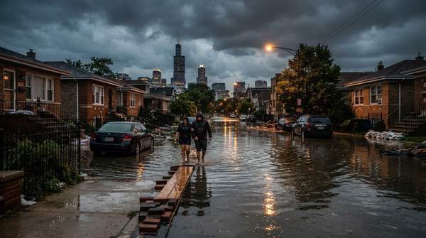
Chicago's urban flooding stems from five interrelated causes identified by regional planners: flat environmental conditions, climate change driving more intense rainfall, the extent and location of development, the design and maintenance of stormwater systems, and regulatory structure. The fix is necessarily two-tiered: regional agencies and local governments pursue gray and green infrastructure, stormwater utility fees, and open-space protection, while residents can take property-level steps such as checking sewage systems and advocating for community-based mitigation planning.
Introduction: Understanding Chicago's Urban Flood Challenge
This article addresses urban and basement flooding in the Chicago region, not riverine flooding from the Chicago River or Lake Michigan. Urban flooding is water entering buildings and streets when local drainage fails, and it happens in three main ways: sewage backs up through basement plumbing, overland sheet flow pushes water in through basements or at-grade windows and doors, and groundwater seeps through foundations under hydrostatic pressure. Cracks in basement walls and floors can also let water in.
The problem is not marginal. In July 2026, more than 3 inches of rain — nearly a month's worth — fell over the July 4 weekend, and Deep Tunnel, Chicago's system of more than 100 miles of underground tunnels and reservoirs built to hold floodwater, was nearly at capacity for the first time in the city's history, as reported by WBEZ. That near-miss illustrates how close the region's engineered defenses sit to their limits.
The Five Core Causes of Urban Flooding in Chicago
The Chicago Metropolitan Agency for Planning (CMAP) organized the region's flood causes into five categories: environmental conditions, climate change, development extent and location, stormwater system design and maintenance, and regulatory structure. These factors are interrelated, meaning a flooded basement usually reflects several causes working at once rather than a single failure.
Chicago's largely flat topography contributes to flooding in two distinct ways, according to CMAP's analysis. Meanwhile, climate change is intensifying rainfall: extreme events increasingly overwhelm sewers designed for a different era. Development patterns compound the problem, because impervious surfaces prevent natural absorption and increase runoff. Research published in IOPscience analyzing crowdsourced Chicago flood reports found that the percentage of impervious surfaces, the age and quality of infrastructure, and neighborhood-level socioeconomic disparities drastically influence flood risk — factors often simplified in traditional hydrological models, which also struggle to capture basement flooding at street-level scale.
Finally, many older cities, including Chicago, use combined sewer systems that carry sewage and stormwater in the same pipes. The University of Illinois Chicago notes that combined systems serve roughly 40 million people across 772 communities, and that when heavy rains exceed capacity, untreated waste is released in what is known as a combined sewer overflow. Chicago's Deep Tunnel was designed to hold 2.3 billion gallons of untreated wastewater during storms precisely to prevent such overflows and basement flooding.